
MORNING: Sunny and mild with temperatures in the 80s by 8 a.m. and 90s after 10 a.m. as south breezes blow at 10-20 mph.
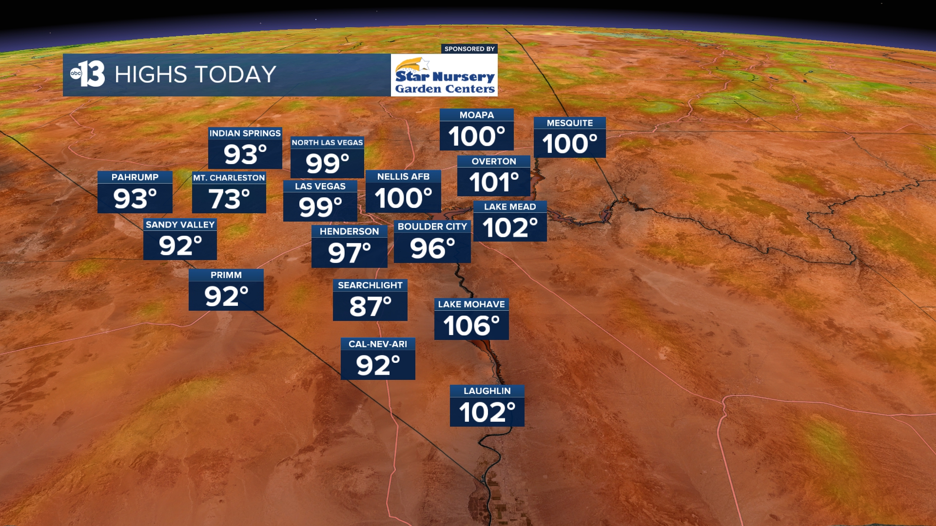
AFTERNOON: Southwest winds at 20-30 mph with a forecast high of 99 and increasing high clouds. There’s a Red Flag Warning (fire danger) and a Lake Wind Advisory (choppy boating conditions) in effect today.
EVENING: Southwest breezes at 15-25 mph with readings in the 90s until 10 p.m.
TONIGHT: Lows in the mid 70s with 10-20 mph breezes.
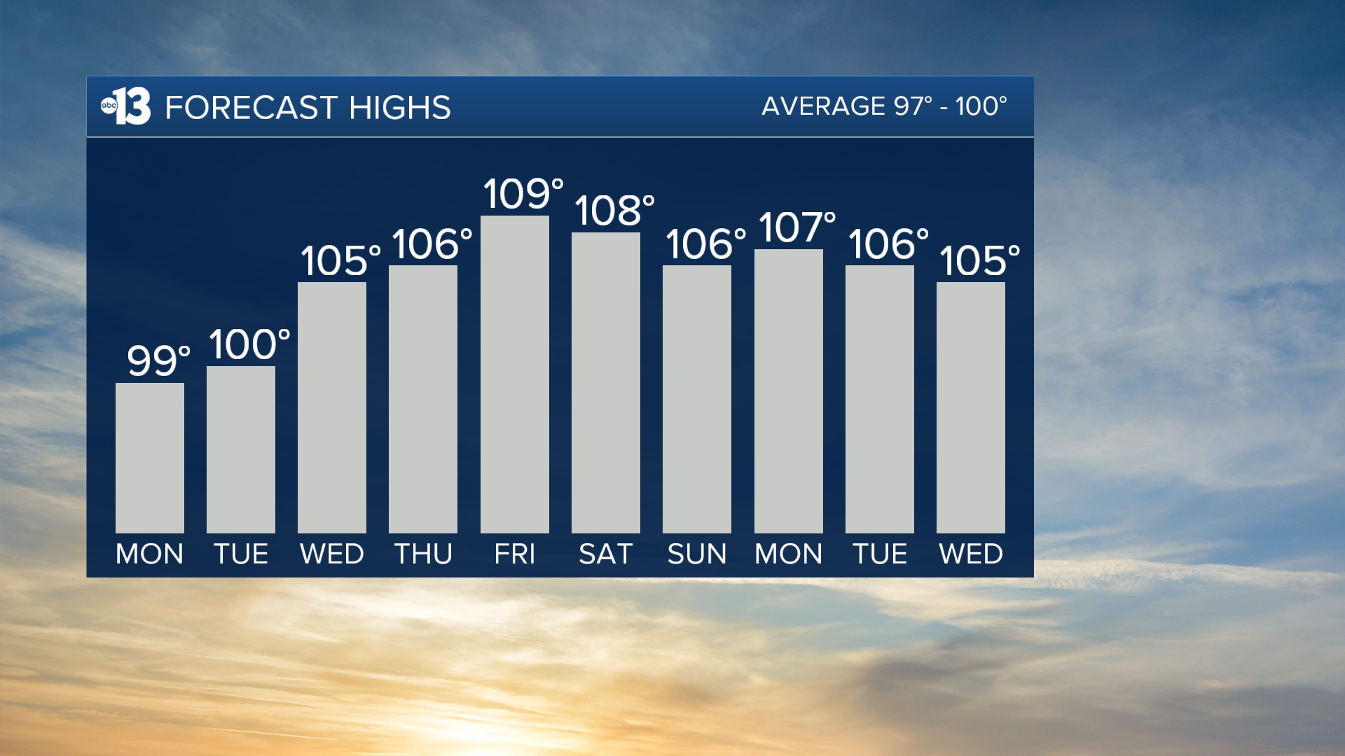
Wind gusts on Tuesday linger at 25 mph as highs approach 100 after starting in the 70s and 80s early in the morning.
The heat ramps up considerably this week. Wednesday hits 105, Thursday 106, Friday 109, Saturday 108, Sunday 106, and Monday 107. We’ll still be near 105 through the middle of next week. No records highs will be tied or broken, but we will be almost 10 above-average.
The air quality forecast is “moderate” due to particle pollution this week.
Forecast pollen levels are “medium” with ragweed, grasses, and olive listed as the predominant pollen types. Showering and changing after you’ve been outdoors, keeping windows closed when it’s windy, and vacuuming and dusting often will help battle symptoms, in addition to taking allergy medication.
Sun protection is advised between 9 a.m. and 5 p.m.; a hat, light-colored clothing, and sunscreen are important when you’re outside. The UV index is strong enough between 10 a.m. and 3 p.m. that a sunburn can happen in just 15 to 30 minutes.


