
MORNING: High clouds and sunshine with wake-up temperatures in the 60s. Light breezes at sunrise will increase by late morning to 10-20 mph.
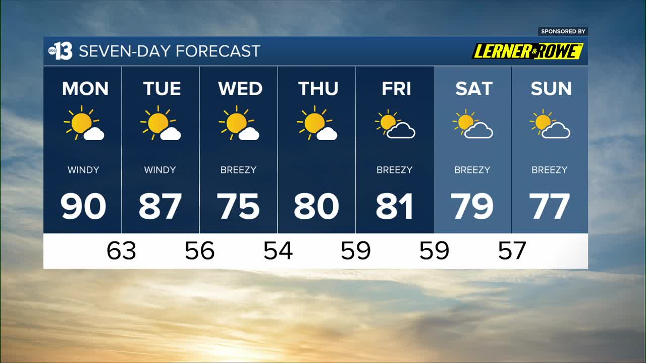
AFTERNOON: Warm with highs near 90 as south winds increase to 15-30 mph under a mostly sunny sky.
EVENING: Expect southwest breezes at 15-20 mph under a partly cloudy sky with temperatures in the 70s by 9 p.m.
TONIGHT: Lows in the low 60s with southwest breezes at 10-15 mph and a partly cloudy sky.
South and southwest winds continue Tuesday, strengthening from 10-15 mph in the early morning to 25-35 mph in the afternoon and 30-40 mph in the evening. Highs Tuesday will be in the mid 80s after starting in the 60s in the early morning.
Tuesday night remains windy, with west-southwest winds at 15-30 mph and lows in the mid 50s.
Wednesday is a bit cooler, in the mid 70s, as winds linger at 15-20 mph under a mostly sunny sky.
Thursday is calm, with mostly sunny conditions and highs near 80 after waking up to the mid 50s.
Friday is partly cloudy and 81 (after starting in the upper 50s) with west-southwest breezes at 10-20 mph.
The weekend ahead looks decent: upper 50s each morning with highs in the upper 70s each afternoon and partly cloudy conditions.
Highs will be near 80 for the first half of next week as dry conditions continue.
Forecast pollen levels are “high” this week and ragweed, olive, and grasses are the predominant pollen types. Showering and changing after you’ve been outdoors, keeping windows closed when it’s windy, and vacuuming and dusting more often will help battle symptoms, in addition to taking allergy medication.
The air quality forecast is “moderate” today and tomorrow (ozone, dust, particles).
The UV index is “high” from 11 a.m. through 2 p.m., when a sunburn could happen in 15 to 30 minutes. Sun protection is advised between 10 a.m. and 4 p.m. today; a hat, light-colored clothing, and sunscreen are important when you’re outside.


