


MORNING: Partly cloudy and humid with upper 80s at daybreak. Expect a 20% chance for a passing shower or thundershower after 10 a.m.
AFTERNOON: Partly cloudy and humid and hot with a high of 104. Expect a 20% chance for a passing shower or thundershower.
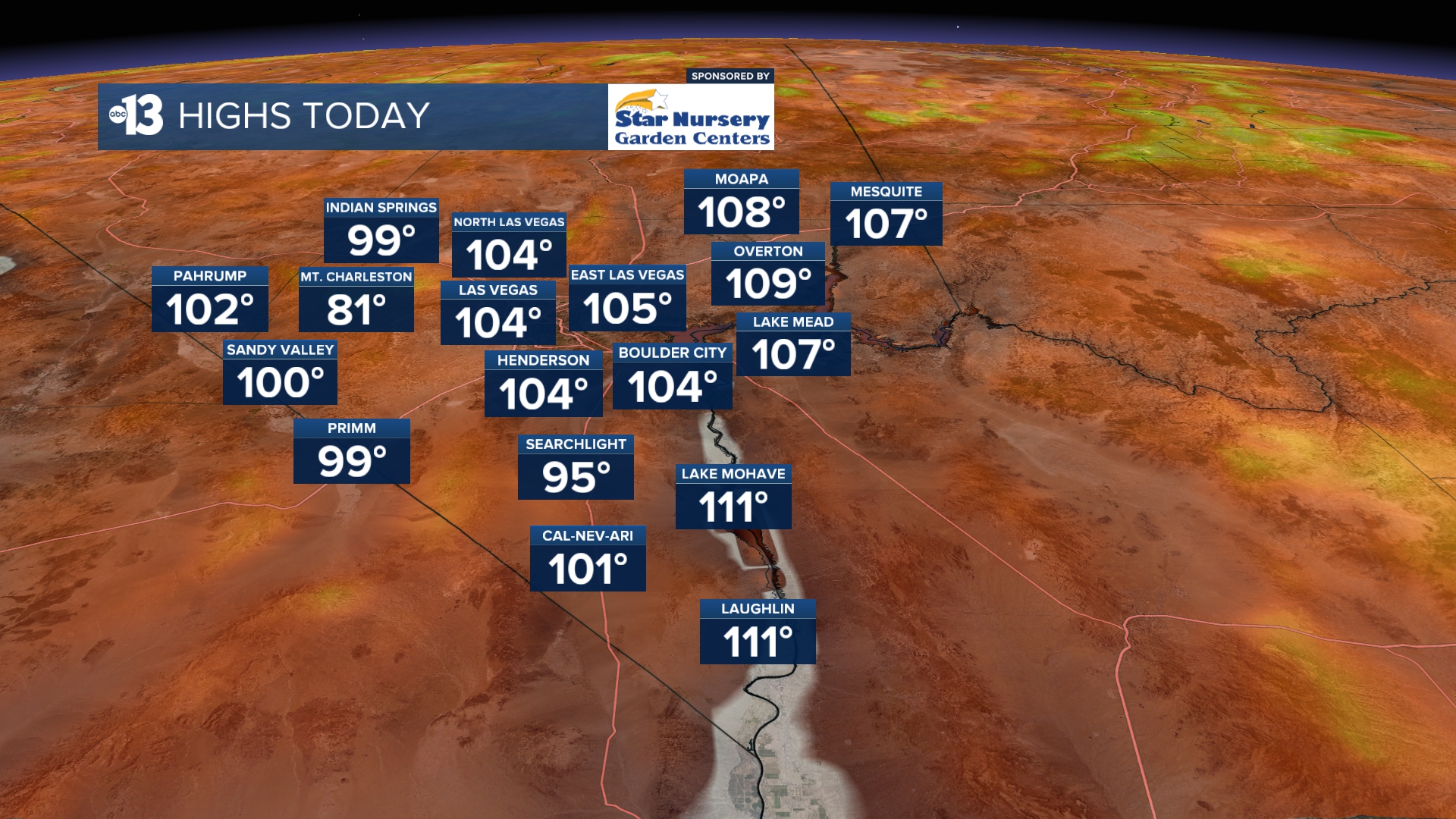
EVENING: Partly cloudy and humid with readings in the 90s.
TONIGHT: Partly cloudy and humid. Lows briefly dip to the upper 80s late.
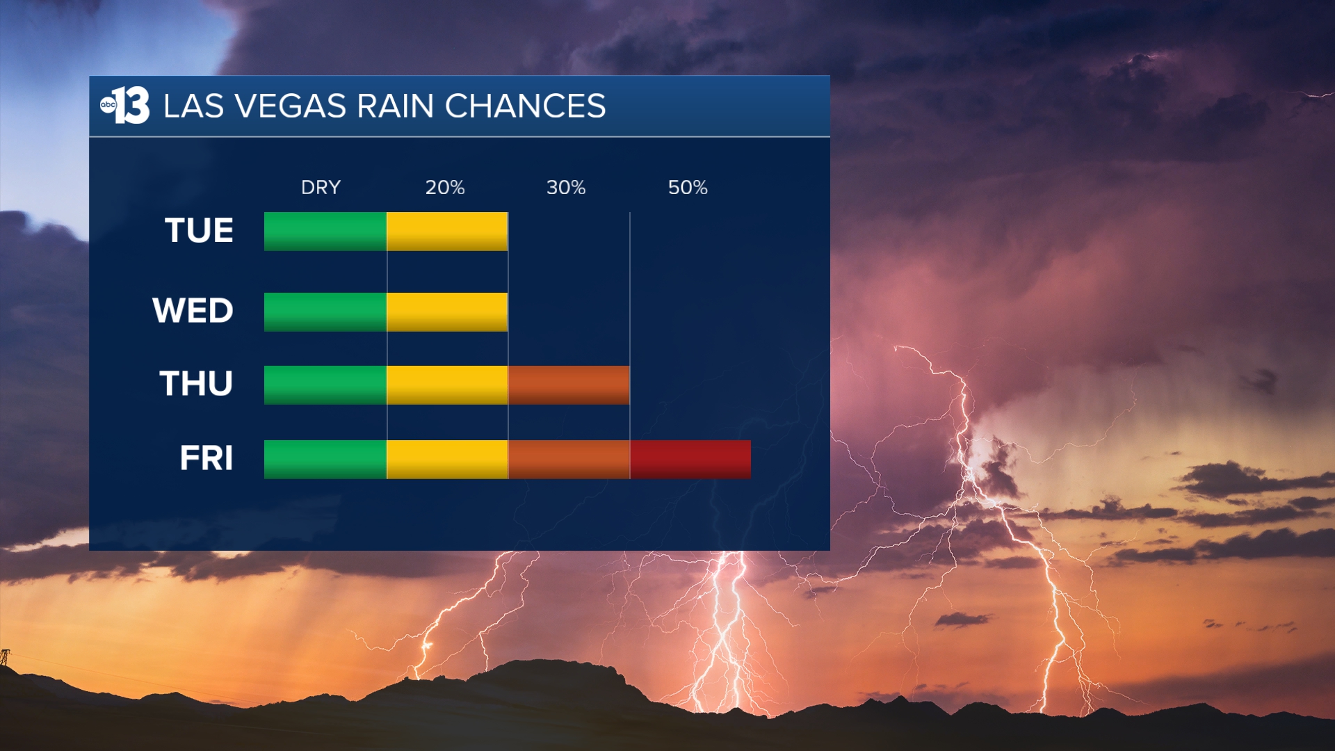
The muggy weather set-up remains in place for the foreseeable future, so expect the spotty storm chances to continue.
Wednesday’s chance is back to 20%, with 30% Thursday, 50% Friday, 30% Saturday, and 20% Sunday and Monday.
Highs range between 103 and 108 over the next week. Nighttime and early morning lows remain warm, in the upper 80s.
Despite an increase in clouds this week, sun protection is still advised between 9 a.m. and 5 p.m.; a hat, light-colored clothing, and sunscreen are important when you’re outside. The UV index is strong enough between 10 a.m. and 4 p.m. that a sunburn can happen in just 15 to 30 minutes. From noon to 2 p.m. a sunburn is possible in just 10 minutes!
Forecast pollen levels are “low” this week, with ragweed, grasses, and chenopods listed as the predominant pollen types. Showering and changing after you’ve been outdoors, keeping windows closed when it’s windy, and vacuuming and dusting often will help battle symptoms, in addition to taking allergy medication.
The air quality forecast is “good” today and tomorrow!