

MORNING: Partly cloudy and humid with upper 80s and low 90s at daybreak.
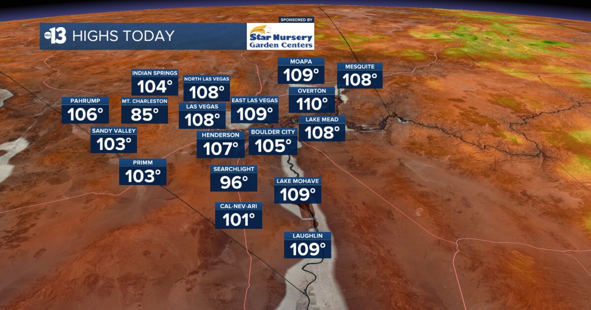
AFTERNOON: Partly cloudy and humid and hot, with a high of 108, and a 10% chance for a shower or thundershower. Better chances in the mountains. Best chances to our east in Arizona and Utah, where Flash Flood Watches are posted. South breezes at 10-20 mph.
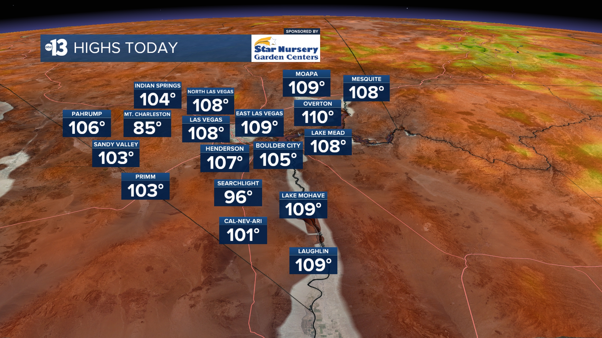
EVENING: Partly cloudy and humid with readings above 100 through midnight. A lingering 10% chance for a shower or thundershower. South breezes at 10-20 mph.
TONIGHT: Partly cloudy and humid. Lows briefly dip to the upper 80s late.
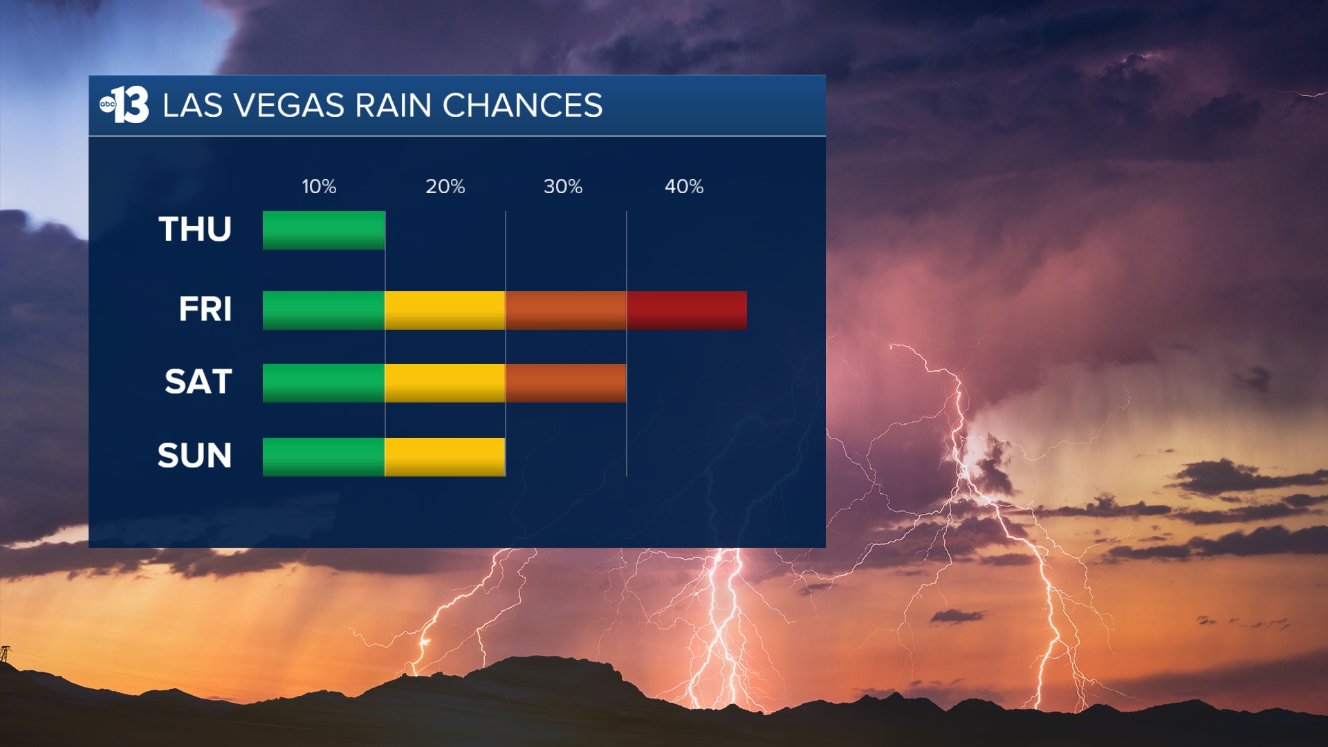
Storm chances rise to 40% Friday as south winds linger at 10-20 mph. Storm chances remain near 30% Saturday and 20% Sunday into early next week.
Highs range from 103 to 105 Friday through next week. Nighttime and early morning lows remain warm, in the mid-to-upper 80s.
Despite an increase in clouds this week, sun protection is still advised between 9 a.m. and 5 p.m.; a hat, light-colored clothing, and sunscreen are important when you’re outside. The UV index is strong enough between 10 a.m. and 4 p.m. that a sunburn can happen in just 15 to 30 minutes. From noon to 2 p.m. a sunburn is possible in just 10 minutes!
Forecast pollen levels are “low” this week, with ragweed, grasses, and chenopods listed as the predominant pollen types. Showering and changing after you’ve been outdoors, keeping windows closed when it’s windy, and vacuuming and dusting often will help battle symptoms, in addition to taking allergy medication.