
MORNING: Mostly sunny and cooler than it has been; wake-up temperatures are in the 70s.
MIDDAY: Partly cloudy, with a 20% chance of an isolated thunderstorm. Highs return to the mid 90s.
THIS EVENING: Falling to the low 90s after sunset, lows in the upper 70s late.
Highs trend from the mid 90s Thursday, with a mostly cloudy sky, and another minor rain chance (20%).
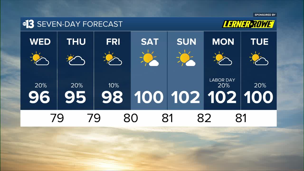
Friday heats up to 98 with a lingering 10% rain chance. The weekend looks mostly sunny and is even hotter, near 100 Saturday and 102 Sunday. Readings near 100 early next week are close to average for late August.
Minor pop-up storm chances on Labor Day (20%) and Tuesday as highs range from 102 to 100.
When it’s not stormy or cloudy, the UV index is still “very high” from 11 a.m. to 2 p.m. (sunburn in 15 minutes). Sunscreen, a broad hat, and light-colored, lightweight clothing are smart if you’re outside for any length of time between 9:00 a.m. and 4:00 p.m.
The forecast pollen levels are “medium” this week, with ragweed, chenopods, and grass listed as the predominant pollen types.


