

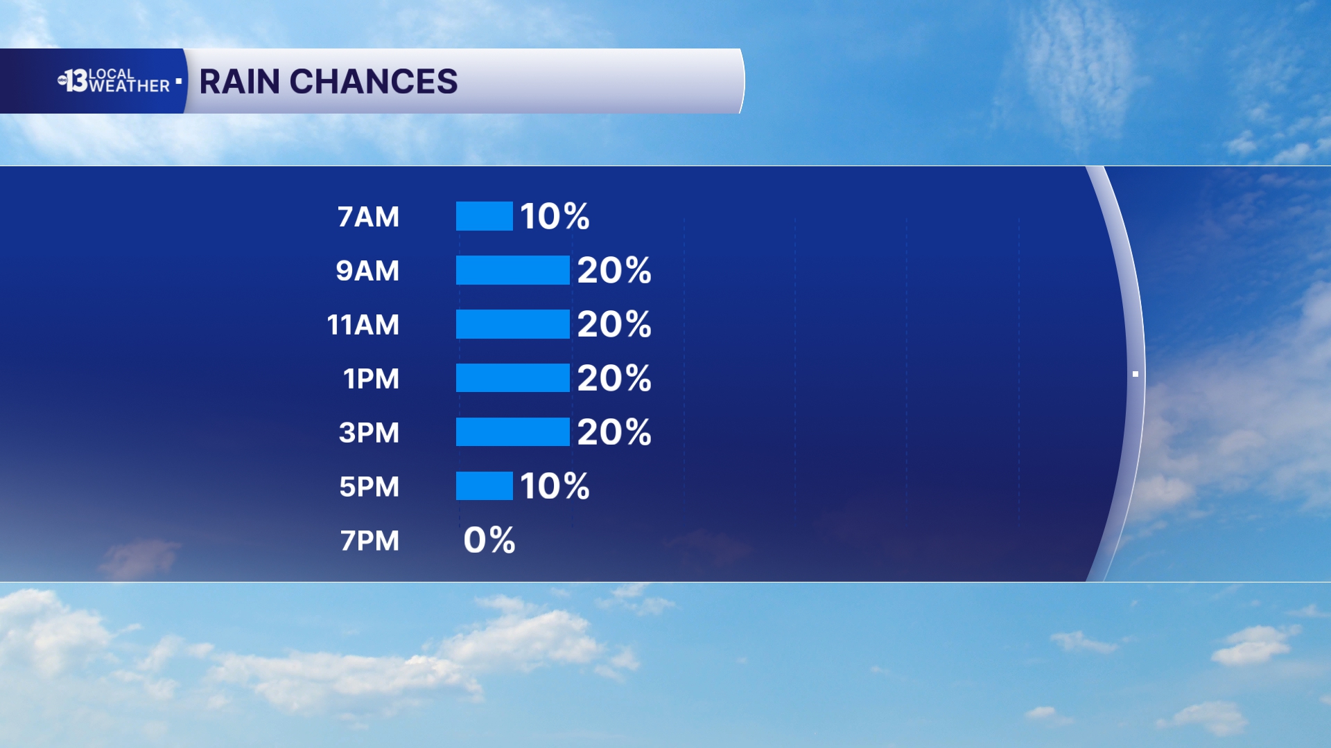
MORNING: Grab a jacket – readings are in the 50s in Las Vegas for the first time since early May! There’s a 20% chance of some showers as a band of clouds and a shift in the wind crosses Southern Nevada. Developing winds from the northwest at 15-30 mph will accentuate the chill!
AFTERNOON: Expect northwest winds at 15-25 mph and highs in the mid-60s. This is the first time since late April that Las Vegas has seen highs in the 60s! A 20% chance of a passing shower lingers into the afternoon.
EVENING: Readings drop into the 50s by 9 p.m. with a clear sky and lingering northwest breezes at 10-20 mph.
TONIGHT: Lows in the low 50s with upper 40s in some cooler neighborhoods under a clear sky with a few northwest winds at 10-20 mph.
<hr></hr>
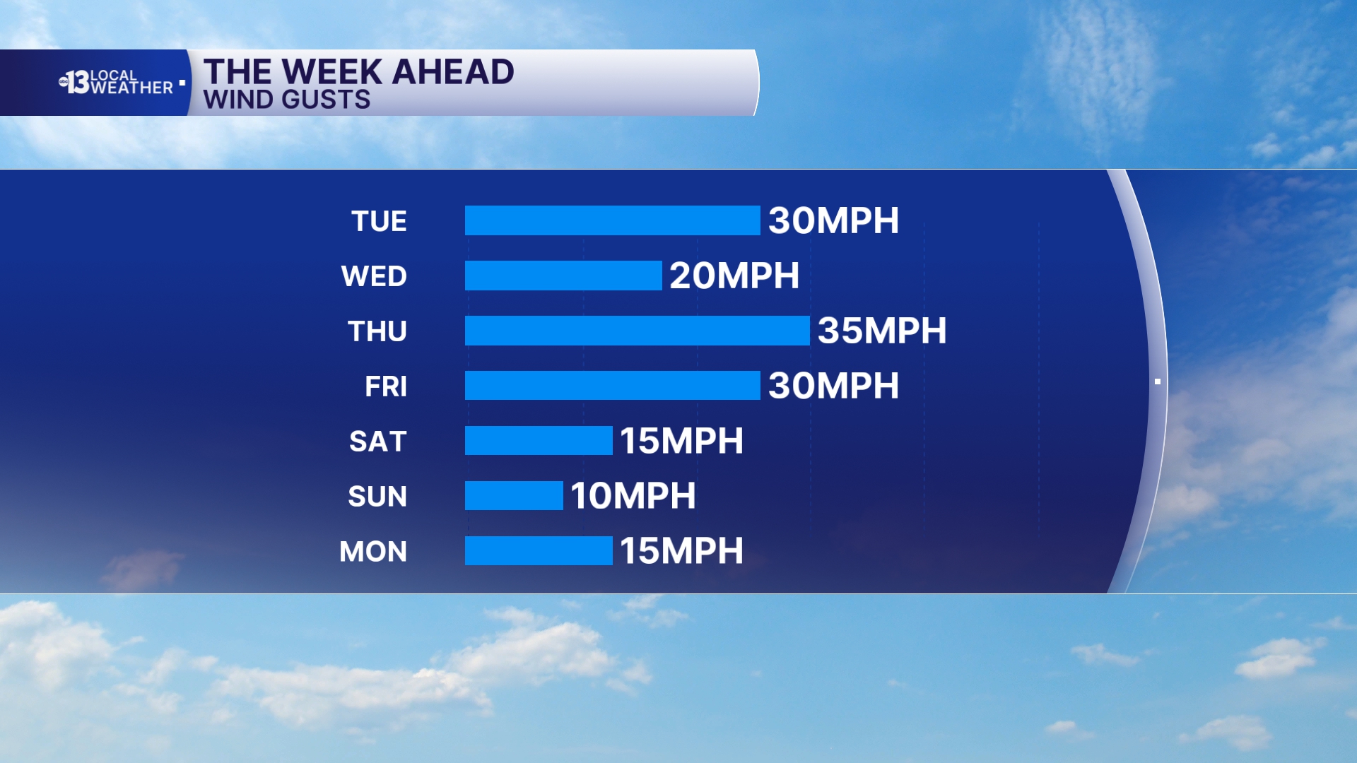
After a chilly start in the low 50s Wednesday morning, sunshine pushes afternoon highs back to the low 70s in spite of north breezes at 10-20 mph.
Thursday starts off in the mid 50s with north winds at 15-30 mph, and we expect winds at 20-35 mph during the daytime. Highs reach the 70s with a sunny sky.
Thursday night sees windy conditions with north winds at 20-40 mph, which keeps lows in the low 60s.
Friday sees continued north winds, with gusts of 35 mph in the morning and 20 mph in the afternoon. It will be mostly sunny with daytime highs in the upper 70s.
The weekend ahead looks superb: light winds with daytime highs in the upper 70s Saturday and low 80s Sunday.