MORNING: Mostly cloudy with readings in the low-to-mid 50s and south breezes at 5-10 mph.
AFTERNOON: Partly cloudy with highs in the upper 60s and light northeast winds at 5-10 mph.
EVENING: Partly cloudy with light winds at 5 mph and readings falling to the 50s.
TONIGHT: Partly cloudy with light winds and lows near 50
Friday is mostly sunny with north winds at 5-15 mph and highs near 70.
Valentine’s Day is Saturday! It starts with sun and chilly readings in the 40s and 50s early. The sky turns partly cloudy in the afternoon as highs return to 70 with southeast breezes at 10-15 mph.
Sunday turns mostly cloudy and breezy, with south winds at 15-25 mph and afternoon readings in the upper 60s.

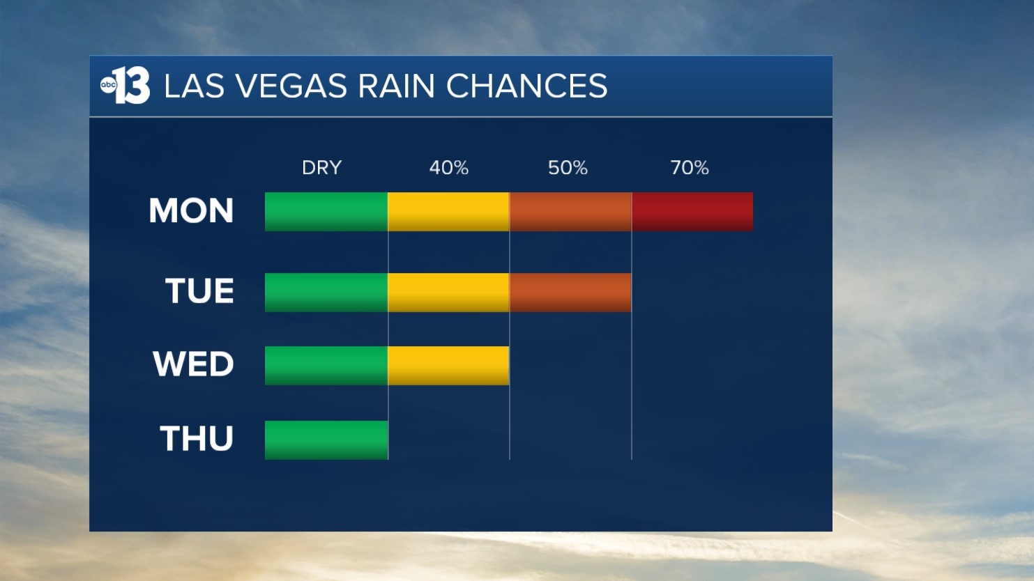
It’s safe to say winter is not done with Las Vegas just yet: Monday only reaches 64 as a 70% rain chance develops from daytime through evening. Also, southwest winds are forecast to hit 15-30 mph.
Tuesday and Wednesday see additional rain chances (50% and 40%, respectively) with highs between 59 and 60. Tuesday is still windy (southwest 20-30 mph) but Wednesday’s breezes are more manageable at 15-20 mph.
Thursday looks dry, but still breezy (south 15-25 mph) as highs remain in the upper 50s.
The air quality forecast is “good” for the next few days.
The forecast pollen levels climb from “medium” to “medium-high” this weekend, with ash and juniper listed as the predominant pollen types.
Even though it’s winter, the UV index is “moderate” from 11 a.m. through 1 p.m., meaning a sunburn could happen in 45 minutes for some people, so grab a hat if you’re outside for that long around midday.