


MORNING: It’s in the upper 80s at sunrise and the low 90s are here by 8 a.m. We’ll hit 100 by 10 a.m.
AFTERNOON: High of 110 with mostly sunny conditions and south breezes at only 5-15 mph.
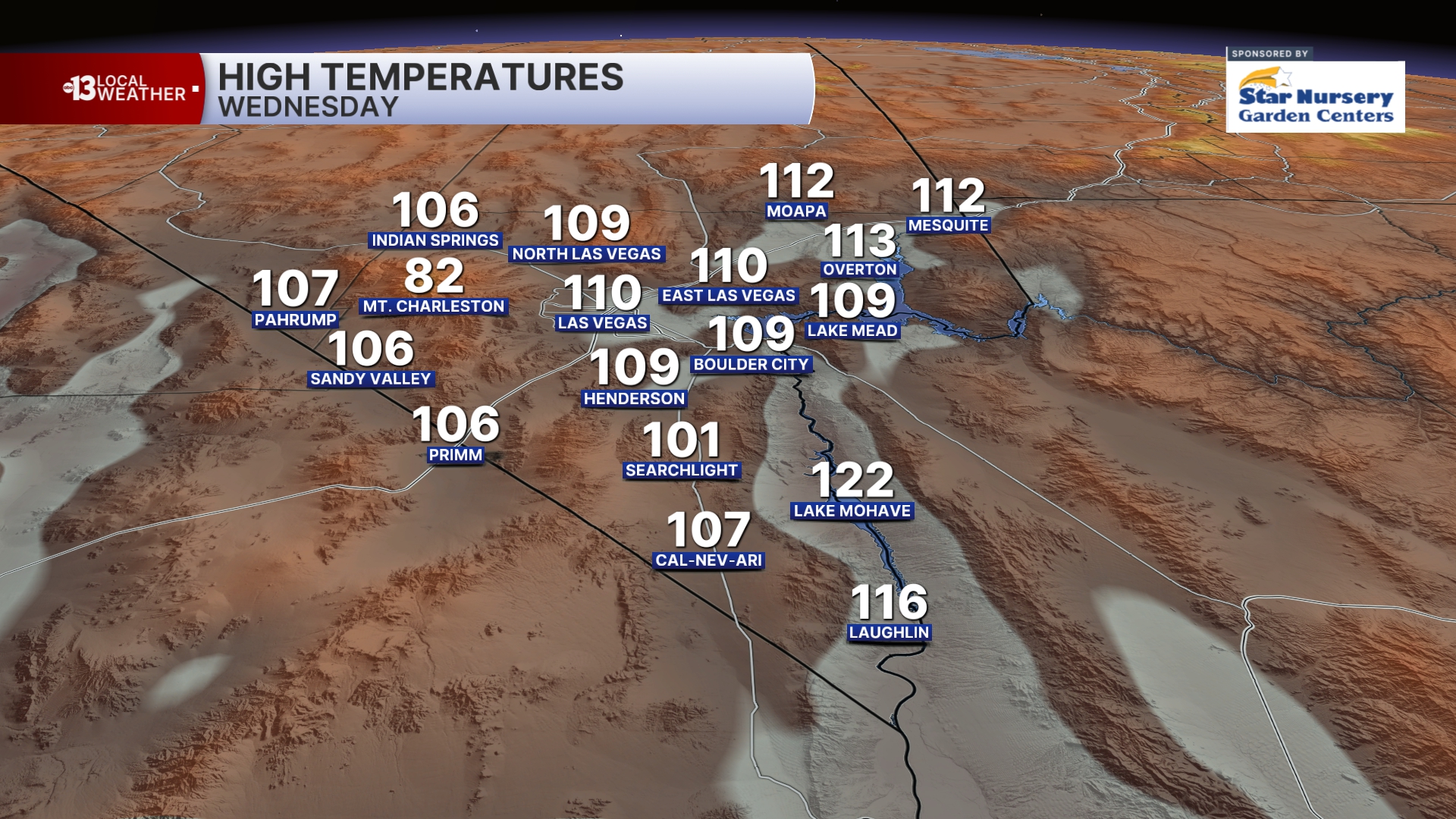
EVENING: Warm and mainly clear, dropping to the 90s by 10 p.m.
TONIGHT: Turning partly cloudy with lows in the upper 80s.
An Extreme Heat Warning continues on Thursday (110) and Friday (108) even as clouds increase and a 10% rain and storm chance returns to the forecast. Gusts reach 25 mph Thursday and 30 mph Friday.
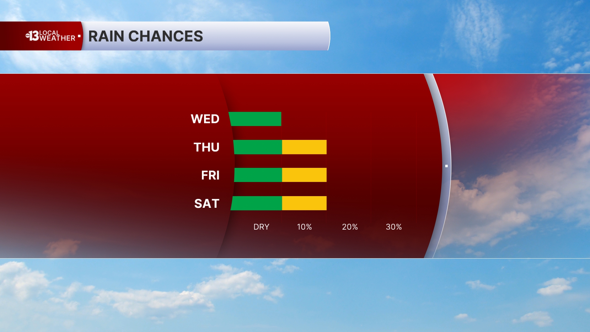
Warm nights and early mornings (mid-to-upper 80s) will continue into the weekend.
The air quality forecast is “moderate” today (ozone) and “good” tomorrow.
Weekend highs will reach 106 Saturday and 102 Sunday with 30 mph gusts each afternoon.
Upper 90s are possible early next week, but Monday sees stronger gusts of 35 mph. Tuesday is still windy (30 mph gusts) before lighter breezes develop next Wednesday.
Sun protection is advised between 9 a.m. and 5 p.m.; a hat, light-colored clothing, and sunscreen are important when you’re outside. The UV index is strong enough between 11 a.m. and 2 p.m. that a sunburn can happen in just 15 minutes.
Forecast pollen levels are “moderate” this week with ragweed, chenopods, and grasses listed as the predominant pollen types. Showering and changing after you’ve been outdoors, keeping windows closed when it’s windy, and vacuuming and dusting often will help battle symptoms, in addition to taking allergy medication.